Companion@360 → 7 Month programme to sharpen your writing skills → REGISTER NOW

Cyclone Nivar
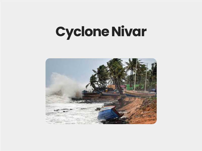
Cyclone Nivar : A cyclone is a general term for a weather system in which winds rotate inwardly to an area of low atmospheric pressure. For large weather systems, the circulation pattern is in a counterclockwise direction in the Northern Hemisphere and a clockwise direction in the Southern Hemisphere.
- As per the guidelines of the World Meteorological Organisation (WMO), it is necessary for countries to name cyclones in their regions.
- This makes it easier for media and government to identify the cyclone and raise awareness regarding it.
- There were several names suggested for this cyclone like Nisarga was listed by Bangladesh while India’s suggestion was Gati. However, eventually, the name Nivar or Nivara was finally chosen from Iran’s list.
Impact of Cyclone Nivar:
- The main threats after Cyclone Nivar’s landfall are likely to be flooding, swollen rivers, lightning, the collapse of kutcha houses, and fallen trees due to gale winds. A power outage is also possible due to potential damage near the coastal areas.
- Isolated extremely heavy rains are also very likely over coastal and north interior Tamil Nadu and Puducherry, particularly the districts of Thanjavur, Tiruvarur, Nagapattinam, Cuddalore, Chennai, Kanchipuram, Chengalpattu, Myladuthirai, Ariyalur, Perambalur, Kallakurchi, Villupuram, Tiruvannamalai, Puducherry, and Karaikal .
- Andhra Pradesh’s Nellore and Chittoor districts will also experience isolated extremely heavy falls.
Landfall:
- The storm moving over the land after its intensification in the ocean (heat source). Therefore, a cyclone is said to make landfall when the centre of the storm (eye) moves across the coast. The tropical cyclones are usually formed in warmer seas.
- As per the US National Hurricane Centre definition, it is ‘the intersection of the surface centre of a tropical cyclone with a coastline’.
- The strongest winds of the cyclone are not at the centre, but at the immediate surroundings of the eye of the storm—usually stronger on one side of the centre.
- Therefore, very high wind speed can be experienced over the land area when the cyclone is near the land, even when it does not make landfall. It can be vice versa too, where the cyclone can make landfall but leave the strongest wind over the ocean.
- The landfall usually brings with it high-speed winds, severe storm surge and torrential downpour, all of which can have a severe impact on the region.
IMD:
- The India Meteorological Department (IMD) is an agency of the Ministry of Earth Sciences of the Government of India. It is the principal agency responsible for meteorological observations, weather forecasting and seismology.
- The India Meteorological Department (IMD) has released a list with the names of 169 tropical cyclones that are likely to emerge over the north Indian Ocean, including the Bay of Bengal and the Indian Ocean.
WMO:
- WMO is a specialized agency of the United Nations (UN) with 193 Member States and Territories. It is the UN system’s authoritative voice on the state and behaviour of the Earth’s atmosphere, its interaction with the land and oceans, the weather and climate it produces and the resulting distribution of water resources.
- The WMO/ESCAP Panel on Tropical Cyclones (PTC) at its 27th Session held in 2000 in Muscat, Oman agreed in principle to assign names to the tropical cyclones in the Bay of Bengal and the Arabian Sea.
- This list contained names proposed by the eight-member countries of WMO/ESCAP PTC, viz., Bangladesh, India, Maldives, Myanmar, Oman, Pakistan, Sri Lanka and Thailand
- The requirement for a fresh list of tropical cyclones including representation from five new member countries: Iran, Qatar, Saudi Arabia, United Arab Emirates and Yemen (total 13 member countries) was tabled during the 45th session of WMO/ESCAP, held in September 2018. The session was hosted by Oman.

