
About us
Civils360 IAS Academy
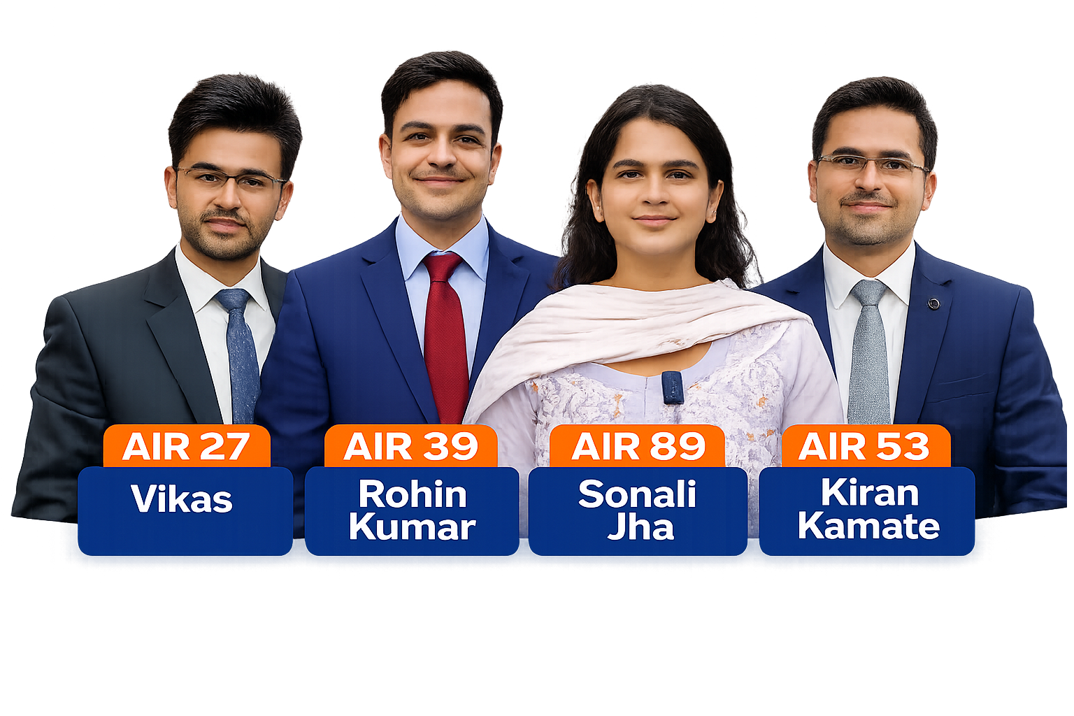
Civils360 IAS Academy is Kerala's No.1 institute for Civil Services preparation, known for delivering consistent and credible results. In 2026 alone, Civils360 produced 75+ selections, including 15 ranks in the Top 100, establishing its position as a leader in UPSC coaching.
Our flagship One-Year Mains Companion Program has been a game-changer, with 6 Top 100 ranks emerging directly from this structured mentorship including Vikas (27), Rohin (39), Sachin (41), Kiran (53), Neelesh (77), and Sonali (89). At Civils360, we focus on concept clarity, answer writing mastery, and personalized guidance, ensuring every aspirant is equipped to perform at the highest level.
Driven by results, backed by mentorship, and trusted by toppers — Civils360 is where serious aspirants transform into successful civil servants.
- Top-rated IAS coaching commitment in Kerala
- Experienced mentors and structured preparation
- Regular evaluation and personalised guidance
- Practical, disciplined, result-oriented plans
Our promise
Your Success Is Our Commitment
Join a focused learning ecosystem with experienced mentors, structured preparation, regular evaluation, and personalized guidance.
Start your UPSC journey with a plan that is practical, disciplined, and result-oriented.
Testimonials
Student testimonials
YouTube videos and written words from rank holders — swipe, tap the dots, or follow the bar below as it advances automatically. Scroll inside a quote card to read the full text.
AIR 39 Rohin Kumar — success story
AIR 89 Sonali Jha — UPSC Mains
Excellent Results
500+
Expert Faculty
12+
Google reviews rating
4.8
Explore Our Civil Service Courses in Kerala
Choose from targeted and comprehensive programs designed for every stage of UPSC preparation.
Course
Prelims Sure
Get ready to build a strong foundation for the UPSC Civil Service Exam with focused coaching. Enhance your knowledge and learn effective exam strategies and time management skills.
Course
Mains Sure
Deepen your knowledge and refine your writing skills for the subjective Mains exam. Our experienced faculty guides you in crafting impactful answers with regular evaluation and feedback.
Course
Prelims cum Mains Exam Coaching
Take advantage of our integrated program that prepares you practically for both the Prelims and Mains exams. One of the most effective solutions for comprehensive preparation.
Course
UPSC Civil Services Exam Preparation
A well-structured curriculum covering all aspects of the UPSC exam. This popular program provides resources, guidance, and support to help you achieve your IAS dream.
Course
Online & Offline Foundation Courses
Designed for beginners, college students, and working professionals seeking a basic foundation to kickstart the civil service exam journey.
Course
Online Working Professionals Program
A flexible online program that lets you prepare for the exam at your own pace, without compromising on your career commitments.
Course
Prelims Companion Membership Program
Designed for aspirants restarting preparation after a break. Get personalized guidance and support to pick up from where you left off.
Course
Restart Program
Built for aspirants who paused UPSC prep—whether due to time, work, or earlier attempts. Get a clear study plan, peer support, regular assessments, and mentor guidance at Civils360 so you can restart with focus and reach your goal.
Why Choose Civil360 for IAS Coaching in Trivandrum?
Our outstanding IAS training program in Trivandrum is ranked among the top civil service academies in Kerala for strong outcomes and student-focused mentoring.
Watch
Experienced Faculty
Our experienced trainers are the backbone of our institute. They understand the ins and outs of civil service and stand beside aspirants until they create their success stories.
In-depth Curriculum
Our syllabus includes history, geography, polity, economy, and ethics. Each subject is covered deeply to build strong understanding for both exam and interview.
Success Stories
We take pride in seeing students become accomplished civil servants. This consistency has made Civils 360 one of the top IAS academies in Trivandrum.
Doubt Clearing Sessions
Regular sessions help students ask questions and clarify difficult topics. We encourage every aspirant to share concerns and resolve them early.
Current Affairs Updates
Staying informed builds critical thinking and strengthens exam readiness. We train students to distinguish facts, opinions, and bias with confidence.
Personalised Guidance
Each student is assessed carefully for strengths and challenges. Our mentors provide focused support so learners can improve faster and perform better.
Mock Tests and Practice
Regular mock exams and practice sessions mirror real exam conditions, helping reduce anxiety, improve timing, and boost confidence.
Mentors session
Unlimited Support, Real Guidance
Our mentors stay with you through every stage of UPSC preparation, helping you improve your clarity, confidence, and time-management.

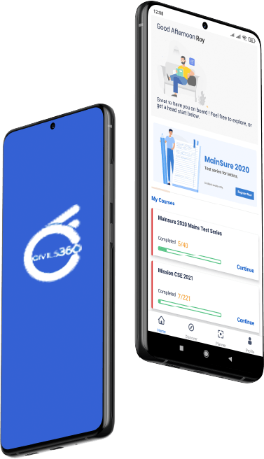
Mobile app
Civils360 IAS Academy
Download our learning app from Google Play Store or App Store to get a full learning experience.
- iOS & Android
- Free download
- Study anywhere
Success Story
Student Success Stories
Listen to the voices of our students. Learn how Civils 360 has shaped their destinies. Know why we are known as the best IAS academy in Kerala.
Neena Viswanath, AIR 496 — UPSC Civil Services Exam 2020.
Civil Service dreams — Civils360 in Malayalam media.
AIR 53 Kiran Kamate — sixth attempt and working professionals.
AIR 39 Rohin Kumar — attempts, marks, and strategy.
AIR 89 Sonali Jha — comeback story and mentorship.
Insights
From the Civils 360 blog
Strategy notes, exam tips, and guidance for UPSC aspirants—grounded in how we teach at our IAS academy in Trivandrum.
Ready to scope your next phase?
Share your drawings, programme, and constraints — we will respond with a clear proposal and timeline.